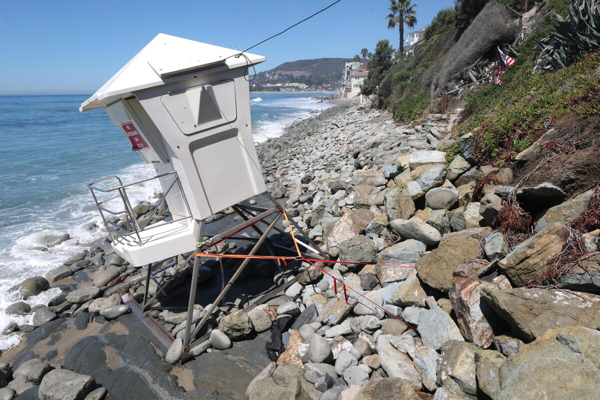
Coastal communities in Southern California are dealing with the aftermath of waves and flooding, while preparing for more potential destruction from a phenomenon called a “coastally trapped Kelvin wave.” Damage has been significant, especially in areas from south Orange County to Malibu, where homes were flooded and severely impacted. The coast from Carlsbad to Long Beach has experienced erosion.
Laguna Beach, Dana Point, and Carlsbad recently declared a local state of emergency due to coastal erosion and sand loss, effects attributed to a south swell from Hurricane Marie. El Niño is known to lead to a more active hurricane season in the eastern Pacific, which is where Hurricane Marie developed.
“I’d been chatting with other cities and city managers up and down the coast, and I think we all had different levels of damage,” Laguna Beach City Manager Dave Kiff said. “I think Laguna’s was among the greatest, or most significant, but everybody talked about concern about sand and sand replenishment.”
Sand replenishment projects are being implemented across regions such as Newport, Huntington, and Seal Beach. Orange County officials have activated their emergency operations center in response to the declarations of local emergencies by more than one city in the county.
Video footage shared by transportation officials reveals severe erosion threatening train tracks used by Metrolink in San Clemente, where strong waves impact the tracks. In San Diego County, Carlsbad is taking action to save Carlsbad Boulevard from severe erosion, as waves inundate homes along Beach Road in Dana Point.
Upcoming El Niño Effects
A “coastally trapped Kelvin wave” is advancing from the coast of Mexico to the U.S. West Coast, anticipated to lead to more damaging storms. Government forecasters project a 75% chance this El Niño will be the strongest since 1950.
Understanding Kelvin Waves
Kelvin waves, central to El Niño, affect global weather as ocean waters in the central and eastern Pacific heat up. These waves have been known for decades, but recent advancements allow scientists to monitor and model them more effectively.
Dillon Amaya, an expert on Kelvin waves, explains how the weakened trade winds during El Niño allow warm water to move eastward. This transfer, aided by Kelvin waves, pushes warmer waters from around Indonesia to normally cooler areas like near Peru. Upon reaching South America, the wave splits, traveling north towards California and south along the coast.
Rising Sea Levels
As Kelvin waves travel along the coast, they elevate sea levels, raise ocean temperatures, and cause nutrient-rich waters to sink. This can result in sea levels rising by as much as 6 to 12 inches, heightening flood risk and beach erosion potential.
Timing of the Wave
Currently moving along the west coast of Mexico, the Kelvin wave is expected to reach the U.S. by early October. It will first enter the Gulf of California, eventually traveling from Cabo San Lucas to San Diego, then on to Los Angeles and San Francisco.
Potential Impacts
This wave isn’t noticeable to swimmers or boaters but is predicted to raise sea levels off California by roughly 6 inches, exacerbating coastal damage especially when storms occur. The state has already experienced a foot of sea level rise from global warming and polar ice cap melt, with unusually high tides exacerbating the situation.
Leave a Reply