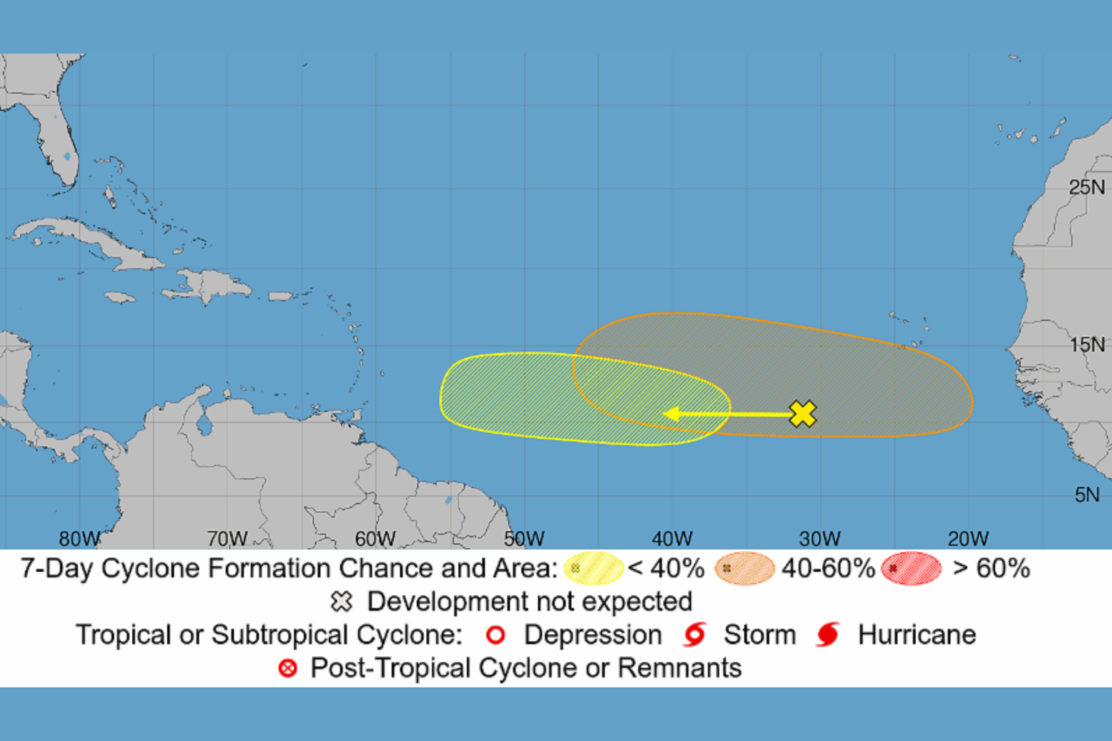
The National Hurricane Center (NHC) is closely observing five areas for possible tropical development across the Atlantic and Pacific. These include two tropical waves in the Atlantic basin that could evolve into tropical depressions later this week, as the 2026 hurricane season gains momentum. While no tropical cyclones are currently active, forecasters are examining a series of disturbances stretching from Africa’s coast to Hawaii’s eastern waters. The NHC noted that the most promising Atlantic disturbance has a 40% chance of developing in the next seven days.
Two Atlantic Systems Under Watch
The NHC’s Atlantic Tropical Weather Outlook highlights a broad area of showers and thunderstorms linked to a tropical wave several hundred miles southwest of Africa’s Cape Verde Islands. This system is moving westward across the central tropical Atlantic and might gradually develop in the early to mid-week. However, upper-level winds—fast-moving air currents in the upper atmosphere—are expected to grow less favorable as the system approaches the Lesser Antilles. It has a near-zero chance of forming in the next 48 hours and a 20% chance over the next seven days.
Another tropical wave expected to move off Africa’s west coast early this week also draws attention. Favorable environmental conditions could allow a tropical depression to form by the latter half of the week as it travels westward across the eastern and central Atlantic. This disturbance has a 40% chance of development within the next seven days.
Three Additional Pacific Threats
In the Eastern Pacific, three areas are under surveillance for development. The most significant is a tropical wave over 1,000 miles east-southeast of Hawaii, producing a large area of disorganized showers and thunderstorms. A tropical depression is anticipated to form in a few days as the system progresses west-northwestward across the Central Pacific, with a 90% chance of developing in the next week.
A second disturbance southwest of the Baja California Peninsula has a 50% chance of forming in the next seven days, while a third low-pressure area off Mexico’s southwestern coast holds a mere 10% chance.
Will Any Hit Land?
Currently, the Atlantic systems are located over open ocean, and Pacific disturbances are generally expected to move westward or west-northwestward. Because these systems lack a well-defined circulation, it is challenging to predict their eventual paths and intensities.
Why It Matters
The increase in disturbances signals the start of a more active phase in the Atlantic hurricane season. Historically, tropical activity peaks in early September, following an uptick in August. Although none of the existing systems threaten the United States directly, meteorologists keep a close watch on tropical waves from Africa. These can develop into tropical storms and hurricanes as they traverse the Atlantic, per The Weather Channel. Presently, the tropical wave anticipated to emerge from Africa this week and the Central Pacific disturbance near Hawaii are the most likely to form the next tropical depressions.
Contact Newsweek editors for this story: Matthew Robinson and Robert Greenall.
Leave a Reply