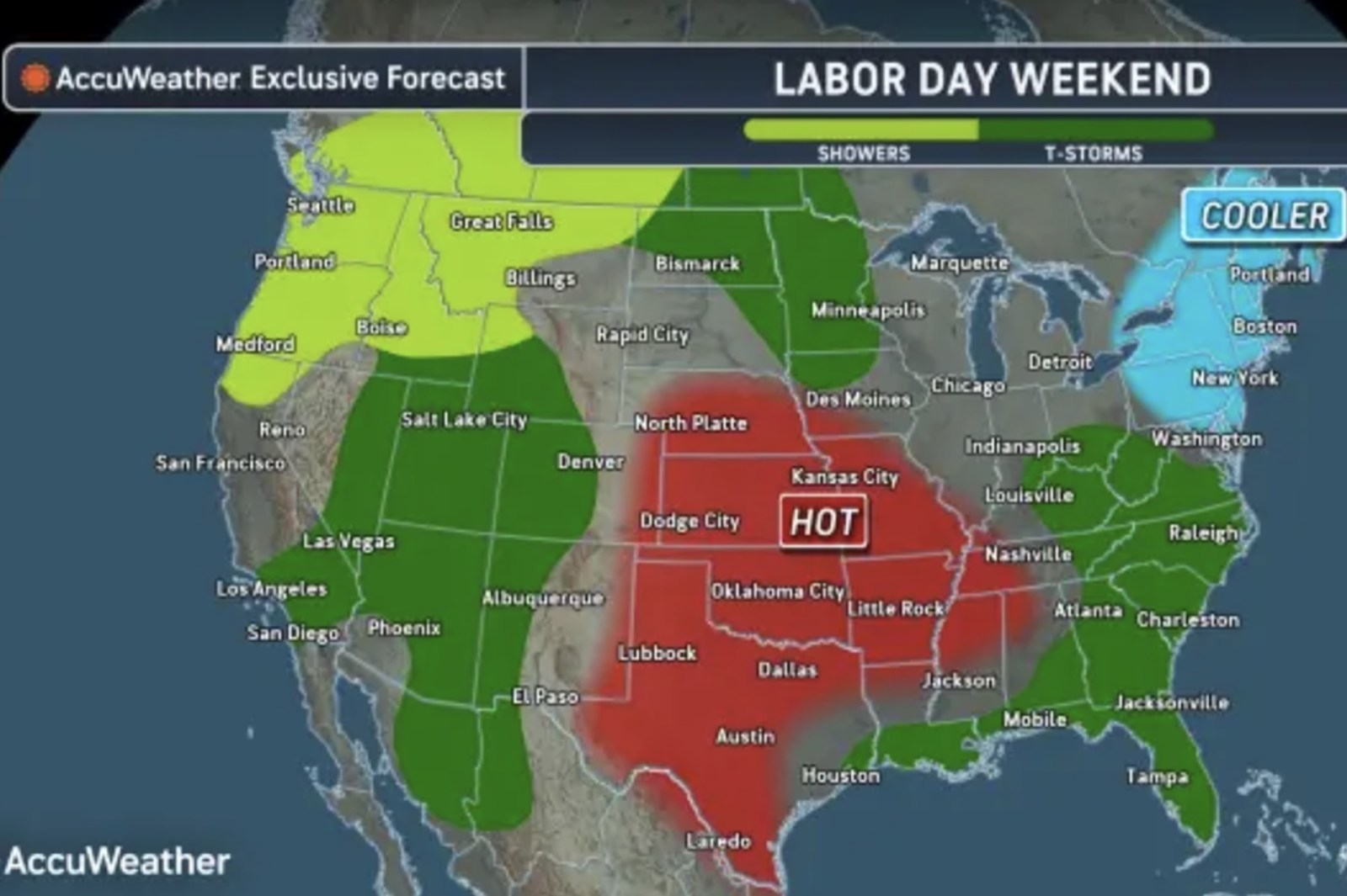
Labor Day weekend brings contrasting weather for the United States. Severe heat is predicted for the central regions, while storms threaten flash floods and disturbances from the West to the Southeast.
Heat Advisories Across Central States
Warnings alert multiple regions in five states of extreme heat due to rising temperatures and humidity. The National Weather Service highlights that extreme heat significantly raises heat-related illness risk.
AccuWeather predicts a massive heat dome causing intense temperatures in the central and southern Plains and Mississippi Valley. Cities such as Texas, Oklahoma, Missouri, Tennessee, and Nebraska may face heat exceeding 100 degrees Fahrenheit through next week. The humidity might intensify these conditions, making it feel up to 15 degrees warmer than actual temperatures.
The National Weather Service forecasts increasing heat in parts of the middle Mississippi Valley, Ohio Valley, Tennessee Valley, and mid-Atlantic starting Wednesday. Heat advisories will cover large areas here due to dangerously hot conditions.
The NWS Weather Prediction Center commented on the record warmth through a persistent high-pressure ridge, predicting continued moderate to extreme heat risks early in the week.
Storms Encircling the Heat Dome
While central areas under the heat dome may stay dry, the surrounding regions could see showers and thunderstorms. The forecast covers parts of the West, northern Plains, Midwest, and Southeast. Some storms could bring heavy rain, flash flooding, and damaging winds.
The National Weather Service anticipates increasing showers and thunderstorms in the Southwest starting Wednesday. They will expand Thursday in size and intensity, producing heavy rain. Showers and thunderstorms are also projected from the Great Basin and central and southern Rockies from Wednesday, extending to the northern mid-Atlantic from the lower Great Lakes.
Understanding Heat Domes
A heat dome occurs when a high-pressure system remains stationary above a region, trapping heat and moisture. This creates sinking, compressed air that raises temperatures in the lower atmosphere, forming a dome. This scenario results in prolonged unusually hot weather with warmer nights, posing elevated heat-related health risks.
Michael Muccilli from NOAA explained that sinking air combined with abundant sunshine intensifies warming. Heat waves in such conditions typically last one to two weeks, potentially longer during drought periods.
Flooding Concerns in Texas
Texas faces increased flood risks following Tropical Storm Edouard’s passage, which weakened to a tropical depression. The storm is expected to move north into Northeastern Texas and dissipate by Thursday morning, yet heavy rains will affect eastern Texas on Wednesday. The National Weather Service warns of localized flash flood risks in urban, road, small stream, and low-lying areas.
AccuWeather also emphasizes potential flash floods around the heat dome’s perimeter, including storm-prone areas in the West causing intermittent heavy rainfall.
Leave a Reply