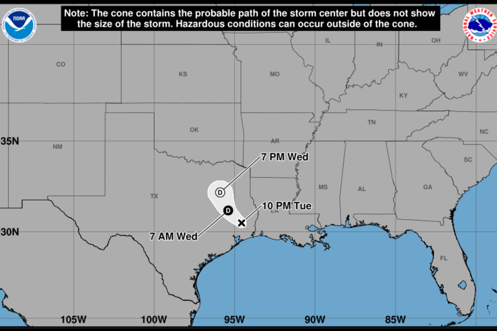
Tropical Storm Edouard is causing significant rainfall, flooding concerns, and travel disruptions across Texas. The storm has weakened to a tropical depression but still poses a serious threat due to widespread rainfall. This could trigger dangerous flash flooding across several state regions.
Edouard’s Rainfall Path
The latest models indicate Edouard is moving northward through eastern and central Texas. The heaviest rain is expected from the upper Texas coast. Although the storm’s exact path is uncertain, the predicted impact zone stretches from the Gulf Coast to eastern and central Texas. This aligns with forecasts predicting heavy rainfall and a high flood risk in these areas.
Shift from Wind to Rain
The National Hurricane Center (NHC) reports that while wind gusts are possible near the storm’s center, heavy rainfall is now the primary threat. River and flash flooding, particularly in urban areas, is likely from the upper Texas coast through east-central Texas and into southwest Louisiana.
Preparation Efforts
Local officials in southeast Texas are actively preparing for the storm. In Montgomery County, emergency managers are coordinating resources, including rescue boats, as flooding concerns escalate. Schools such as Conroe ISD and Willis ISD have canceled classes, and some government offices are closed.
Jason Millsaps from the Montgomery County Office of Homeland Security and Emergency Management highlighted concerns about prolonged rain bands causing significant rainfall in short periods. Officials have set up barricades in flood-prone areas.
Flood Watches in Texas
The National Weather Service (NWS) has issued flood watches for several areas in northeast, east-central, and southeast Texas. In Henderson County and surrounding areas, 1 to 3 inches of rain is expected, with isolated totals of up to 6 inches. Runoff could lead to flooding in waterways and low-lying regions.
Further south and east, a flood watch includes Brazos, Chambers, Harris, Liberty, Montgomery, and surrounding counties. Rainfall of 3 to 6 inches is forecast, with some areas getting 10 to 15 inches, especially east of Interstate 45. During intense downpours, rainfall rates could reach 3 to 4 inches an hour.
Future Projections
Edouard’s remnants are expected to continue inland, bringing moderate to heavy rain across eastern Texas. Despite weakening, flood risks will persist due to repeated rainfall in saturated areas. Officials urge residents to monitor forecasts and adhere to flood warnings. They emphasize the danger of crossing flooded roads, warning that water depths are hard to judge and conditions change swiftly.
Governor Greg Abbott’s office issued a press release on August 31 regarding the state’s preparation for the storm.
Main Concern
For Texans, the primary danger from Edouard is no longer wind but flooding rainfall. This could severely impact roads, residential areas, and waterways, continuing to pose hazards well after the storm fades.
Leave a Reply