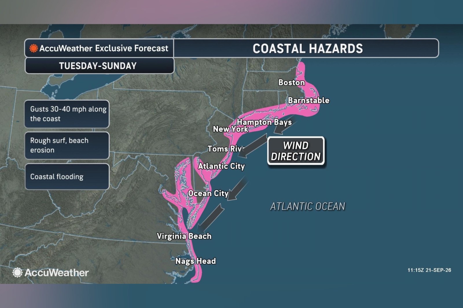
A developing nor’easter may bring substantial rain, high winds, hazardous surf, and flooding to sections of the East Coast this week. Forecasters are still uncertain about the storm’s precise path and intensity.
Understanding Nor’easters
According to the National Weather Service, a nor’easter is a storm along North America’s East Coast, with winds typically blowing from the northeast over coastal regions. While they can form year-round, nor’easters are most intense and frequent from September to April. These storms often result in heavy rain or snow, strong winds, high seas, and occasional coastal flooding.
Forecast Details
The Weather Channel reports that a low-pressure area may develop into a nor’easter off the Northeast coast later in the week. This system could disrupt travel and lead to high surf, rain, winds, and coastal erosion. A high-pressure area is anticipated near the Great Lakes as the low-pressure system moves north along the East Coast. Winds are likely to intensify as the systems converge.
Forecast models offer varied predictions for the low’s path. One model positions the system nearer to the shore, possibly leading to stronger winds, more rain, and increased coastal erosion. Another model places it further offshore, potentially reducing impacts along the Interstate 95 corridor.
AccuWeather forecasts probable coastal flooding from North Carolina to New York from Tuesday through Friday. The threat is expected to extend along the northern Mid-Atlantic coast and into southeastern New England over the weekend. A full moon is expected to elevate astronomical tide levels, which coupled with the storm, could further raise water levels.
“Regardless of development, gusty winds, heavy rain, and coastal flooding may impact parts of the Northeast and mid-Atlantic later this week and into the weekend,” meteorologist Alex DaSilva said. “With leaves still on the trees, strong winds in coastal zones could lead to localized power outages.”
AccuWeather leans toward a track close to the coast, suggesting significant impacts. However, the storm’s final path is expected to become clearer soon.
Additional Predictions
According to FOX Weather, the Outer Banks may face major coastal flooding, intense surf, and heavy rain. Wind gusts could reach 40 to 50 mph, with waves offshore climbing to 15 to 18 feet. Ocean overwash on coastal roads, such as Highway 12, is anticipated.
The FOX Forecast Center predicts “moderate” coastal flooding during high tides, especially in back bays and low-lying coastal roads. This elevated tidal flooding might impact North Carolina, Virginia, Maryland, Delaware, and New Jersey, extending into southern New England.
The low-pressure center is expected to progress north toward the I-95 corridor and New England by the weekend. One potential track might take it closer to Boston, causing 60 to 70 mph wind gusts, heavy rain, a significant storm surge, and disruption near Boston Harbor and the Massachusetts coast. A path closer to Long Island or New Jersey would push the strongest effects south, potentially leaving New York City on the storm’s periphery. If the low stays offshore, coastal New England could face “rough surf, elevated tides, and breezy conditions” while the heaviest rain and winds remain over the ocean.
Leave a Reply