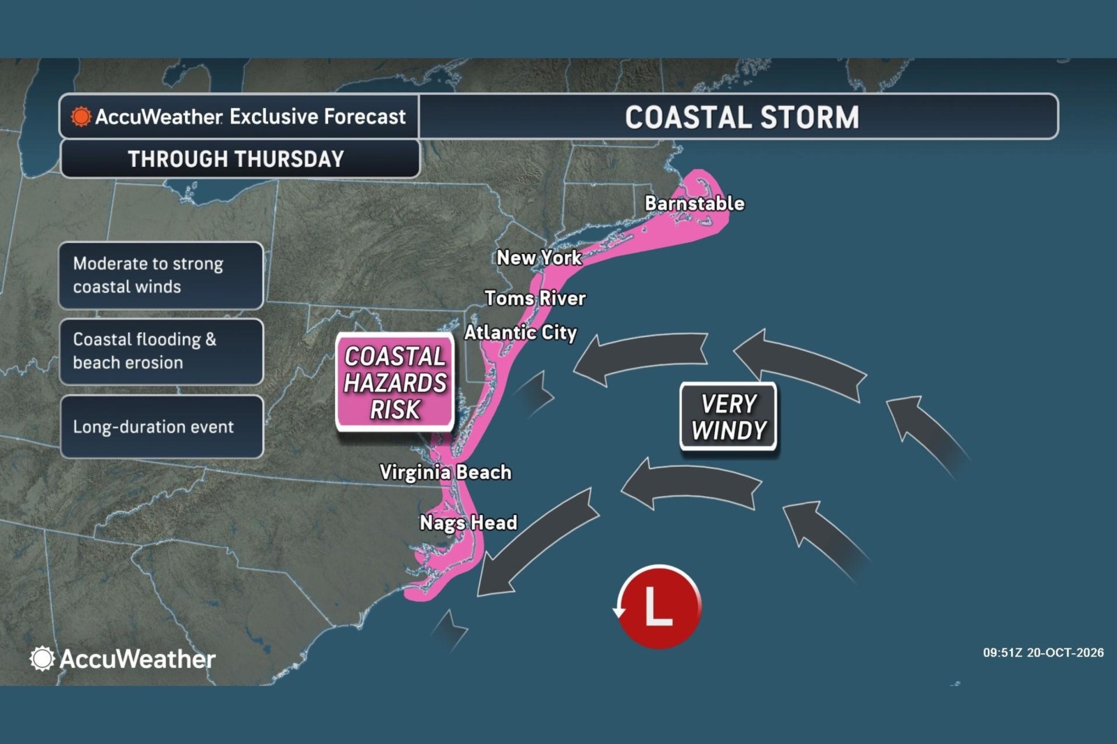
A slow-moving nor’easter is posing a threat to the East Coast, potentially bringing strong winds, coastal flooding, and beach erosion to multiple states through Thursday. A forecast map shared recently pointed out a stretch of coastline from North Carolina to Massachusetts as being at risk for ‘moderate to strong’ winds, coastal flooding, and beach erosion. The storm is expected to gradually move northward offshore, and forecasters at AccuWeather indicated it might acquire tropical or subtropical characteristics while crossing the warm waters of the Gulf Stream.
As of the latest update, the National Weather Service (NWS) has issued coastal flood warnings for parts of New Jersey, Delaware, Maryland, and Virginia. The storm’s center is predicted to shift from the waters off the Carolinas toward the mid-Atlantic, southern New York, and New England. This movement could spread coastal hazards further north through the latter part of the week, according to AccuWeather. It is noted that much of the storm’s moisture would likely remain offshore, with coastal areas facing the most significant impacts while many inland regions stay dry.
From Morehead City, North Carolina, to Atlantic City, New Jersey, the strongest winds were expected through Tuesday, with gusts potentially reaching between 40 and 60 mph, and an isolated maximum of 70 mph. ‘Breezy’ conditions were anticipated to develop further north later in the week along coastal New Jersey, Long Island, southern Rhode Island, and Cape Cod in Massachusetts.
Fox Weather also predicted several days of hazardous conditions, suggesting that the most severe impacts would persist through late Wednesday and into Thursday. The most pronounced flooding threat extended from the Outer Banks through Chesapeake Bay and toward Ocean City, Maryland, where water levels could rise more than 2 feet above normal during high tide.
Forecasters mentioned a possibility of the system briefly becoming a subtropical or tropical storm. Alex DaSilva, AccuWeather’s lead hurricane expert, noted that there is a moderate chance for the area of low pressure off the East Coast to acquire tropical or subtropical features. He indicated that it is likely to be sub-tropical, though a fully tropical system cannot be ruled out. Even if the storm becomes subtropical, the National Hurricane Center (NHC) can still assign it a name.
DaSilva explained that tropical systems derive energy from warm ocean waters, whereas subtropical systems are energized by both warm waters and the jet stream. He mentioned that it is common for nor’easters in October to gain tropical or sub-tropical traits, citing a recent nor’easter that nearly achieved this. Current water temperatures along the Gulf Stream are still warm enough to provide substantial energy to these storms. Regardless of the storm’s development, coastal flooding, dangerous surf, and beach erosion are potential risks along the mid-Atlantic coast this week.
Understanding Nor’easters
The NWS describes a nor’easter as a storm along the East Coast of North America, where winds over coastal regions typically blow from the northeast. These storms can occur at any time of year but are most frequent and intense from September to April.
Leave a Reply