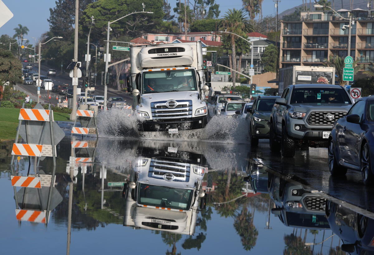
Tropical Storm Rachel is slated to make landfall in northern Baja California or San Diego County by Saturday night. It brings potential hazards like significant coastal flooding. The National Hurricane Center highlights that Rachel might gain strength before reaching the West Coast.
Unusual Weather Conditions
Typically, storms weaken in the cooler waters of the tropical eastern Pacific. Yet, El Niño and a marine heat wave have raised ocean temperatures by 10 to 13 degrees, providing a favorable environment for Rachel. UC Agriculture and Natural Resources climate scientist Daniel Swain noted, “This is an unusual event caused by the early-arriving low-pressure trough and record warm ocean temperatures off California’s coast.”
Flooding Concerns
The National Weather Service in San Diego has issued a tropical storm watch for much of San Diego County, including cities like San Diego, Chula Vista, Carlsbad, and Oceanside. This marks only the second tropical storm watch issued in California.
Coastal flooding is a major worry, especially for south-facing shores. High tides, elevated water levels, and the tropical storm’s arrival create risks. Swells may cause water intrusion, hazardous surf, and rip currents. For instance, Laguna Beach experienced flooding early Friday, with high tides in San Diego and La Jolla rising 17 inches above predictions.
Meteorologist Miguel Miller explains, “We already have high water levels, and with high tides and surf, water enters unusual areas.” A coastal flood advisory for Ventura, Los Angeles, Orange, and San Diego counties warns of flooding in beach parking lots and roads, with potential closures and minor erosion until Tuesday.
Rainfall Expectations
Rachel’s remnants could bring light rain to Southern California from Sunday to Monday night. More significant precipitation might fall in the Mojave Desert, Inland Empire, and parts of San Diego County. The weather service forecasts a moderate 40% chance of excessive rainfall leading to flash floods in areas like San Diego, El Cajon, and Escondido.
Los Angeles County may see light to moderate rain, up to an inch in some areas. The San Gabriel Mountains may receive more rain. Orange County can expect between half an inch to an inch along the coast, with higher amounts further inland in San Diego County.
Historical Context of Tropical Storms in California
Since modern records began, only two tropical storms have impacted California. The first, El Cordonazo in 1939, hit Long Beach and San Pedro with 5.62 inches of rain, 65 mph wind gusts, and 45 flood-related deaths. The second, Nora in 1997, briefly reached tropical storm strength near the California-Arizona border, causing street flooding and coastal property damage.
Nora occurred during a strong El Niño season, linked with increased hurricane activity and rainfall in Southern California. The National Oceanic and Atmospheric Administration’s Climate Prediction Center forecasts a “very strong” El Niño this season, with an 83% chance of being the strongest since 1950.
Past “very strong” El Niños, such as those in 1982-83 and 1997-98, brought over 30 inches of rain to Los Angeles, doubling its average annual rainfall. Meanwhile, the 2015-16 El Niño was dry for Southern California but coincided with record coastal erosion.
Leave a Reply