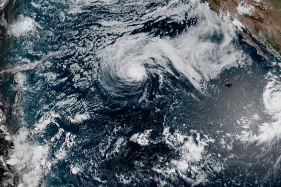
As of Monday evening, Major Hurricane Genevieve moved through the Pacific Ocean, far from any land. Concurrently, Tropical Storm Fausto, now weakening, produced large surf in Hawaii.
Genevieve briefly attained Category 5 status early Monday. This made it the first hurricane of such strength in the East Pacific over the past two years, according to the National Hurricane Center.
Moving parallel to the Mexican coast, Genevieve maintained maximum sustained winds at 145 mph (230 kph). It was positioned roughly 505 miles (810 kilometers) southwest of the southern tip of the Baja California peninsula, heading northwest at 12 mph (19 kph).
Despite no coastal watches or warnings being issued, the hurricane center cautioned that swells from Genevieve could generate life-threatening surf and rip current conditions along parts of Mexico’s southwestern coast and the Baja California peninsula.
The hurricane is predicted to see some fluctuation in intensity but is expected to weaken later in the week.
In the northwestern part of the Pacific, Hurricane Fausto downgraded to a tropical storm by Monday evening. It continues moving in the general direction of the Hawaiian Islands. Forecasts suggest Fausto will pass north of Hawaii, though locals are advised to track its progress for possible impacts.
Hawaii’s east-facing shores are experiencing stronger surf and currents, as the hurricane center noted. Fausto’s maximum sustained winds stand at 70 mph (110 kph). It sits about 415 miles (670 kilometers) east-northeast of Hilo, Hawaii, traveling west-northwest at 16 mph (26 kph).
Leave a Reply