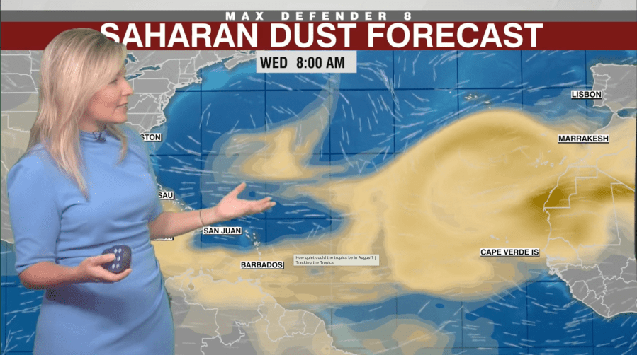
The heat persists and storms are scarce. The southern U.S. is experiencing stunning sunsets, partly due to a layer of dust from Africa’s Sahara desert. This phenomenon, known as the Saharan Air Layer or Saharan dust, travels an impressive journey across the ocean, affecting weather patterns.
Meteorologist Jason Dunion from the University of Miami elaborates on the nature of this dust. It forms a thick layer in the sky, beginning about a mile up. During summer, these dust waves emerge from Africa every three to five days, each covering an area comparable to the lower 48 U.S. states.
The dust season typically peaks between mid-June and mid-August. It significantly influences U.S. weather by inhibiting the formation of storms. “They help cap the atmosphere,” Dunion notes, explaining that this warm, dry layer makes it difficult for thunderstorms and clouds to develop. This factor may be contributing to the calm beginning of the Atlantic hurricane season.
Rebecca Barry, a meteorologist at Nexstar’s WFLA, highlights the presence of an unusual late-season Saharan dust plume. She mentions that the plume resembles those seen in May or June, and its size is rare for this season. This dust suppresses storm formation, reducing the development of tropical storms and hurricanes on their path to the U.S.
The lack of storms results in higher temperatures in the South. “We lose the usual cooling afternoon thunderstorms when Saharan dust is present, driving heat indexes as high as 110 degrees,” Dunion states.
Beyond the South and Gulf, places such as Texas and Arizona are experiencing the dust’s influence. KXAN meteorologist Freddy Vela observed its effects spreading westward.
Another interesting effect of the Saharan Air Layer is the spectacular sunrises and sunsets. When the dust reaches Florida, it scatters light creating a beautiful orange hue at dawn and dusk. “It’s remarkable,” Dunion comments, noting the dust’s journey of thousands of miles across the Atlantic.
Leave a Reply