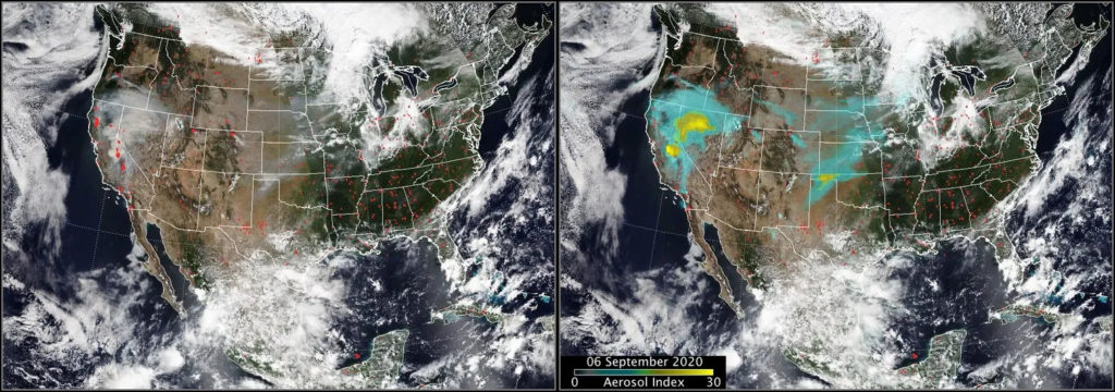
As wildfires increase in intensity globally, researchers have launched an airborne mission to study the severe storm clouds that form over major fires. These clouds, known as firestorm clouds or pyrocumulonimbus (pyroCb), can push smoke into the stratosphere, similar to volcanic eruptions. They cause extreme weather like lightning and firenadoes, yet much of their behavior remains unknown, posing a risk to residents and emergency crews.
This summer, scientists from NASA, the U.S. Naval Research Laboratory (NRL), and the National Center for Atmospheric Research (NCAR) examined these clouds closely. They used aircraft equipped with instruments to measure wildfire smoke plumes. John Yorks from NASA’s Goddard Space Flight Center emphasized the unprecedented nature of their work in capturing data from inside and above the clouds.
The mission, INSPYRE (Injected Smoke and Pyrocumulonimbus Experiment), seeks to gather real-time data to better understand the formation and atmospheric effects of these clouds. David Peterson, a meteorologist at NRL, described the mission as a well-organized storm chase of wildfire-induced storms. The team’s successful deployment included sampling smoke plumes directly and experiencing the orange-hued clouds firsthand.
The Formation of Firestorms
In hot, dry, and windy conditions, wildfires can produce dense smoke plumes. These plumes lift water vapor and smoke particles high into the atmosphere. As the vapor cools, pyrocumulonimbus clouds form and spread at the plume’s top. According to Peterson, these clouds act like chimneys, moving large amounts of smoke upward.
Firestorm clouds create hazardous conditions. They can generate dry lightning, igniting new fires kilometers away. Strong downdrafts produce storm-like winds, endangering firefighters. Michael Fromm from NRL highlighted the amplified danger compared to regular storms or fire events.
PyroCb clouds commonly occur in North America and Australia but are now seen in Europe due to heatwaves. France recorded its first pyroCb cloud in July. Peterson noted that recent events have matched or exceeded the smoke elevation of large volcanic eruptions.
Challenges in Forecasting
Understanding these cloud formations is challenging. They’ve been studied only for 15-20 years. John Yorks emphasized the need to learn more about their formation and interaction with regional weather conditions.
INSPYRE, building on a prior NASA and NOAA study, aims to gather data from within these clouds. Ziming Ke from the Desert Research Institute likened them to a smoky house, underscoring the difficulty in seeing inside. He noted the importance of understanding aerosol types and weather conditions for forecasting.
As smoke rises through pyroCb clouds, it alters its properties. Peterson highlighted the significance of predicting which fires create these clouds and their atmospheric reach. Identifying aerosol particles, like black carbon, is crucial for understanding their role in heating or cooling atmospheric layers.
Collecting Data In-Flight
The INSPYRE team, consisting of at least 150 personnel, coordinated efforts to track storms caused by U.S. Western wildfires. Their aircraft, including NASA’s ER-2, carried remote sensors, and NCAR’s Gulfstream V gathered chemicals and aerosols as it flew through smoke plumes.
This detailed observation aids in creating accurate models of firestorms. The team pursued smoke plumes from Siberia to Idaho, representing the most comprehensive study of such phenomena.
Pursuing further research, the team plans to analyze gathered data and identify future exploration areas. They aim to refine forecast models, thereby improving understanding and response to these severe weather events.
Leave a Reply